question

Jorge Nakandakari avatar image
0 Likes"
Jorge Nakandakari asked Phil BoBo edited

GIS module: calculate route driving roads type doesn't work

Hi,

I’m working on a GIS model to create a distribution plan for our trucks fleet. I need to calculate a distance matrix between each point. I tried with few trucks (less than 20 points) and it works fine, however when I tried 200 points now Flexsim is not calculating driving roads anymore.

Is there a maximum number of points that we can connect in one model to calculate driving road paths.

How I can re-establish the calculation of the routes?

FlexSim 22.2.2
gismapintegration
5 |100000

Up to 12 attachments (including images) can be used with a maximum of 23.8 MiB each and 47.7 MiB total.

1 Answer

Phil BoBo avatar image
0 Likes"
Phil BoBo answered Phil BoBo edited

"FlexSim Routing Server Usage Policy

The FlexSim server usage is restricted to reasonable use-cases from within the FlexSim software. We provide no guarantees with regard to uptime, latency, or data updates."

GIS Navigator (flexsim.com)

If you are making too many requests too fast, then the server's reverse proxy rate limiting DoS-protection features may block your requests for a time.

If you want guaranteed uptime to your requests, you should host your own server or use a paid service. See Open Source Routing Machine, GEOFABRIK, or Fast Routing API.

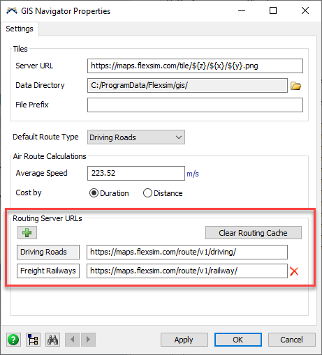
You can specify the routing server URLs in the GIS Navigator Properties:

1663862271875.png

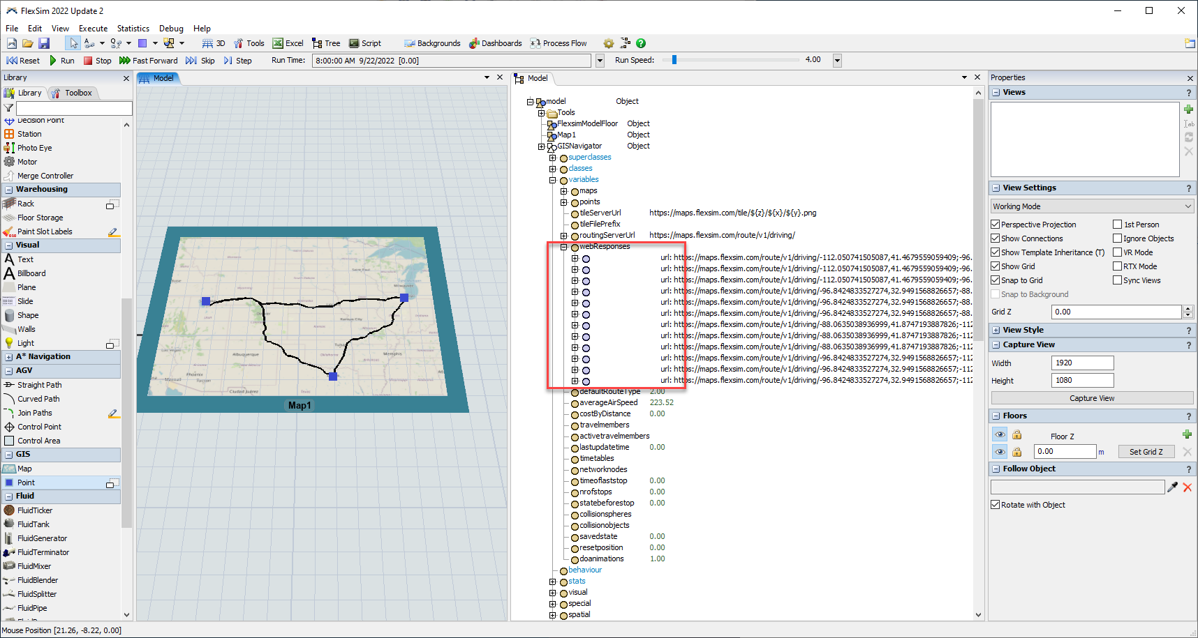
Also, make sure you aren't programmatically deleting and recreating your GISNavigator object. The GIS Navigator keeps a cache of web responses so that if you make the same query multiple times, it only queries the server the first time and then looks up the cached response for subsequent identical queries.

1663861998770.png


1663861998770.png (280.6 KiB)
1663862271875.png (26.6 KiB)
5 |100000

Up to 12 attachments (including images) can be used with a maximum of 23.8 MiB each and 47.7 MiB total.