I would like to see in the map (GIS Module) the intensity about one or more variables in each place (country, states, cities) using a tool like a heatmap. How can i do that in FlexSim?
If you would like this feature please suggest it as an idea in the Ideas section on this site.
Hi @Maíra A!
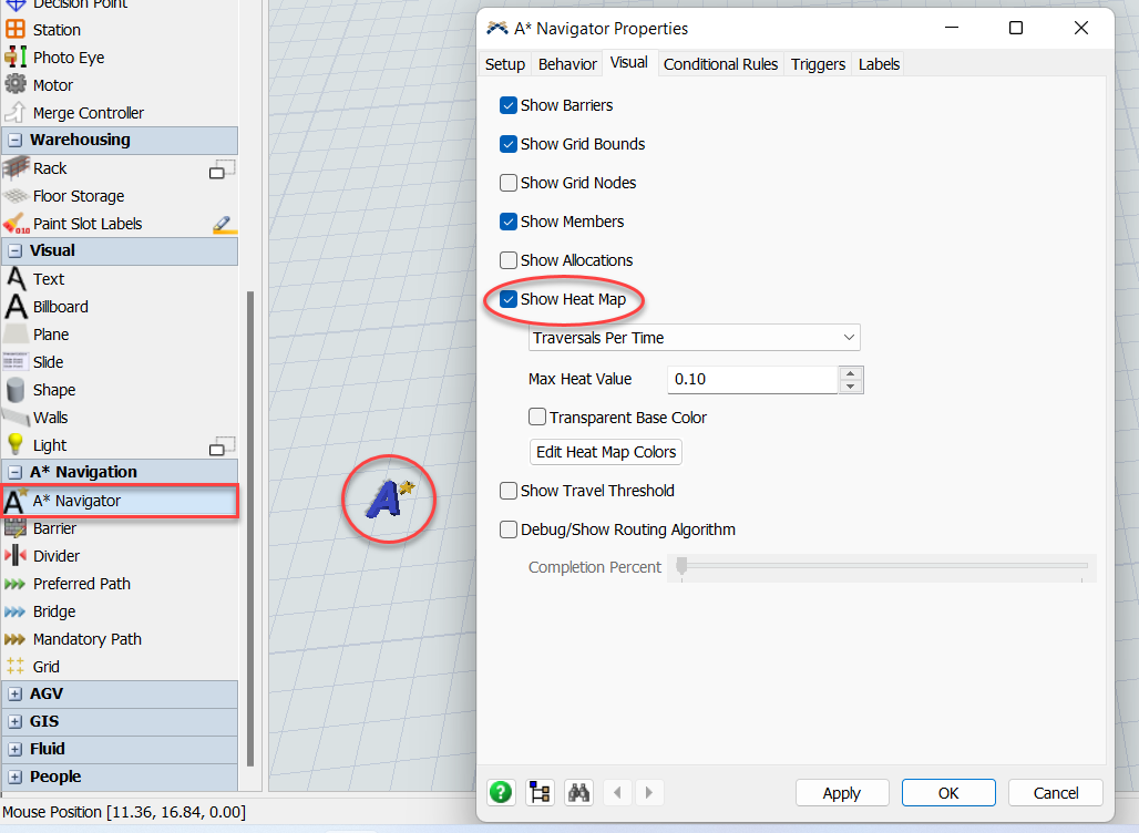
Although GIS does not currently support the creation of a heat map, there are other tools that do. The A* navigator, for example, has a heat map option within properties > visuals tab.
Another option would be to generate the data in FlexSim and export it to another software, I know Power BI has an extension called Synoptic that allows you to generate heat maps: How to use Synoptic Panel - OKVIZ .
Finally, as @Jason Lightfoot pointed out, if you would like to see the option to create a GIS heat map, please suggest it in the Ideas section, new ideas are always appreciated!
@Jason Lightfoot and @Marco G8 thank you for your answers, i really need to post it like an idea. I'll do that.
15 People are following this question.
