Hello,
Is it possible to assign a token label to get the latitude and longitude of a task executer in a certain instant while it is moving on a GIS Map?
I appreciate any help and a possible sample model.
Regards.
Hello,
Is it possible to assign a token label to get the latitude and longitude of a task executer in a certain instant while it is moving on a GIS Map?
I appreciate any help and a possible sample model.
Regards.
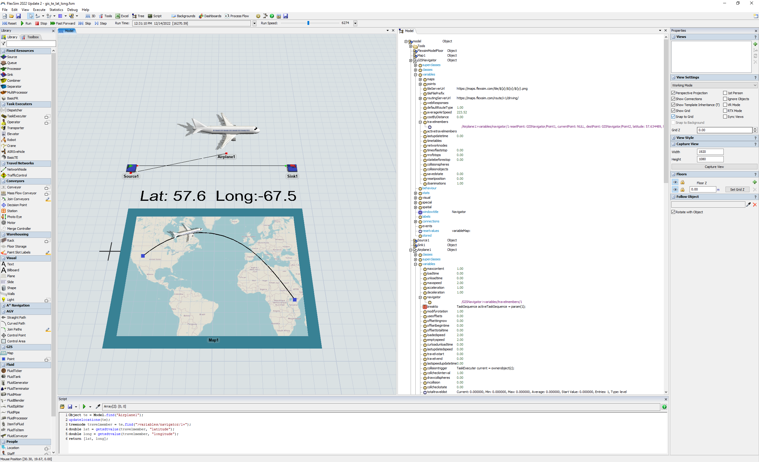
Object te = Model.find("Airplane1");
updatelocations(te);
treenode travelmember = te.find(">variables/navigator/1+");
double lat = getsdtvalue(travelmember, "latitude");
double long = getsdtvalue(travelmember, "longitude");
return [lat, long];
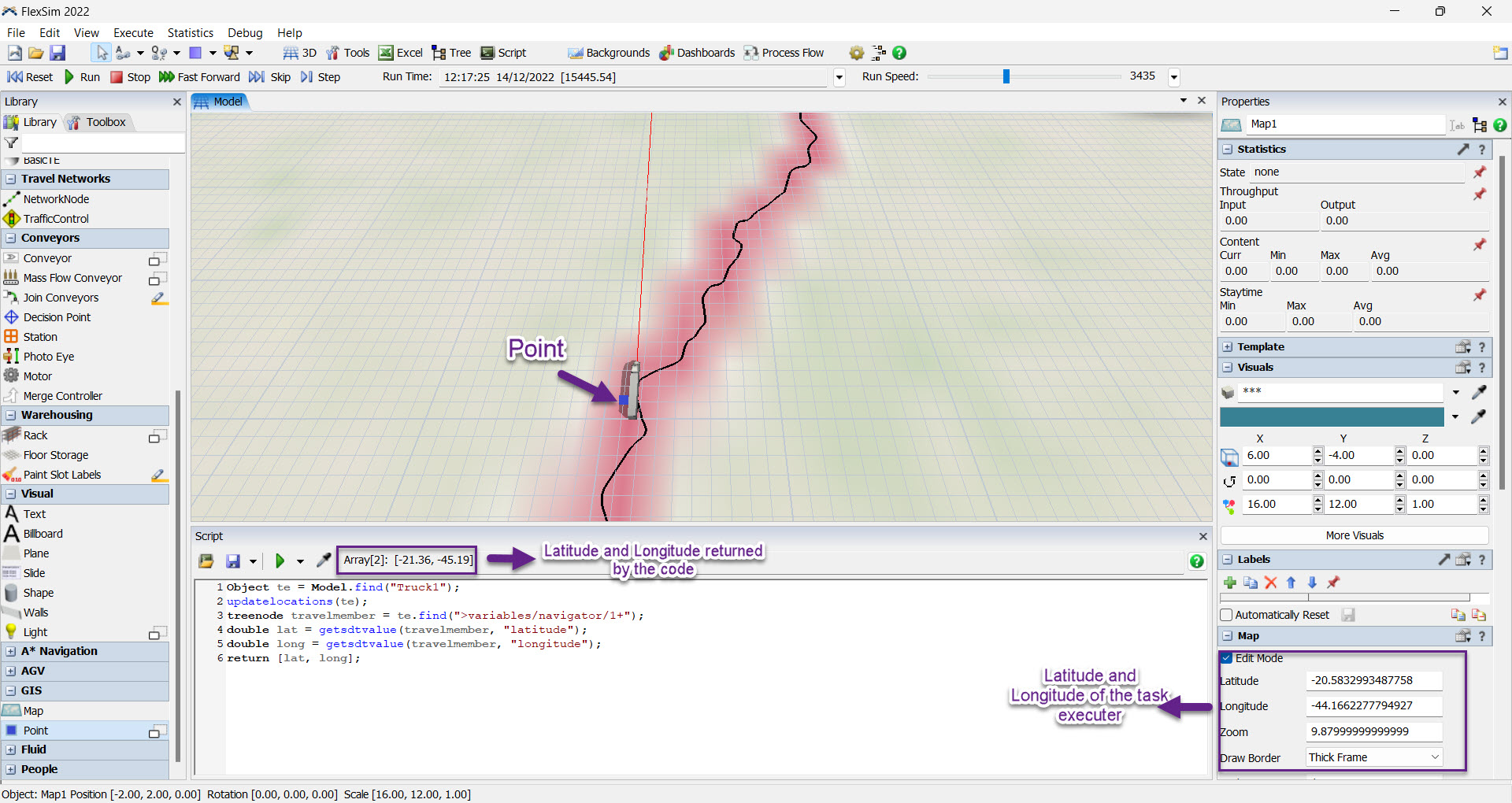
Just to make sure if the code is working, you can stop the model, execute the code and add a point near it to verify the latitude and longitude. In the picture you can see that the code is working.
Thank you, so much @Phil BoBo for the solution, and @Gustavo Teodoro for the verification hint. It will help me a lot.
15 People are following this question.
FlexSim can help you understand and improve any system or process. Transform your existing data into accurate predictions.
FlexSim is a fully 3D simulation software environment. FlexSim can be used to simulate any process in any industry.
FlexSim®, FlexSim Healthcare™, Problem Solved.®, the FlexSim logo, the FlexSim X-mark, and the FlexSim Healthcare logo with stylized Caduceus mark are trademarks of FlexSim Software Products, Inc. All rights reserved.