Hello to all,
Is there a way to have automatic route for ships in GIS module? (currently there are air, road and rail options)? Thanks in advance.
BR, Vlad
Hello to all,
Is there a way to have automatic route for ships in GIS module? (currently there are air, road and rail options)? Thanks in advance.
BR, Vlad
If you are aware of a routing server that has data for shipping routes, you can add it via the GIS Navigator properties:
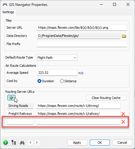
I'm not aware of any OSRM routing servers that have maritime or shipping routes. The closest I could find is OpenSeaMap which provides map visualization of nautical data but no routing information as far as I can tell.
If you want shipping routes on a map, add them yourself via connected points using rhumb lines (if the ship follows straight headings) or flight paths (if the ship follows the curvature of the earth). Then set the durations for the routes based on how fast your ships travel.
This answer details an approach using searoutes.com:
Hello Phil,
Thanks for the reply, then thats how it will have to be.
Best regards, Vladimir
14 People are following this question.
FlexSim can help you understand and improve any system or process. Transform your existing data into accurate predictions.
FlexSim is a fully 3D simulation software environment. FlexSim can be used to simulate any process in any industry.
FlexSim®, FlexSim Healthcare™, Problem Solved.®, the FlexSim logo, the FlexSim X-mark, and the FlexSim Healthcare logo with stylized Caduceus mark are trademarks of FlexSim Software Products, Inc. All rights reserved.